Strait of Hormuz coordinates
26°36′N 56°30′E, or 26.6, 56.5 in decimal degrees. Below: the same point in every notation you might need, plus the coordinates of the narrows and the two entrances.
| Measure | Figure |
|---|---|
| Strait of Hormuz (DMS) | 26°36′N 56°30′E |
| Decimal degrees | 26.6, 56.5 |
| Degrees and decimal minutes | 26° 36.0′ N, 056° 30.0′ E |
| Plain decimal, lat/long order | 26.600000, 56.500000 |
| Approximate narrows | 26.5–26.7°N, 56.2–56.5°EBetween the Musandam Peninsula and the Iranian coast. A span, not a point. |
| Persian Gulf entrance, approx. | 26.5°N, 56.0°E |
| Gulf of Oman entrance, approx. | 26.3°N, 56.8°E |
| Hormuz Island | 27.06°N, 56.46°E |
| Datum | WGS 84 |
The figure, and what it actually denotes
The coordinate pair you will find cited for the Strait of Hormuz is 26°36′N 56°30′E, which is 26.6, 56.5 in decimal degrees. That is what Wikipedia’s entry carries and what most atlases plot.
It is worth being clear what such a coordinate means for a feature of this kind. The strait is 167 km long and up to 95 km wide. A single pair identifies a representative point roughly in the middle, in the same way that a coordinate for a country identifies somewhere near its centre rather than the country. If you are placing a marker on a map, this is the number you want. If you are describing a position in the strait, it is not.
Converting between notations
Three notations are in common use and mixing them is the usual source of error.
- DMS — degrees, minutes, seconds
- 26°36′00″N 56°30′00″E. The traditional form, still standard on charts. One minute is one sixtieth of a degree; one second is one sixtieth of a minute.
- DMM — degrees and decimal minutes
- 26° 36.0′ N, 056° 30.0′ E. What GPS receivers and most marine electronics display, because a minute of latitude is a nautical mile and the arithmetic stays convenient.
- DD — decimal degrees
- 26.6, 56.5. What mapping APIs and GIS software take. Convert from DMS by dividing minutes by 60 and seconds by 3600 and adding: 36 ÷ 60 = 0.6, so 26°36′ is 26.6°.
- Sign conventions
- Both values here are positive: north of the equator and east of the Greenwich meridian. A negative latitude is south, a negative longitude west. Nothing in this region takes a negative sign, which removes the most common pasting mistake.
Points along the strait
For most purposes the useful coordinates are not the strait’s centre but the places people are actually asking about.
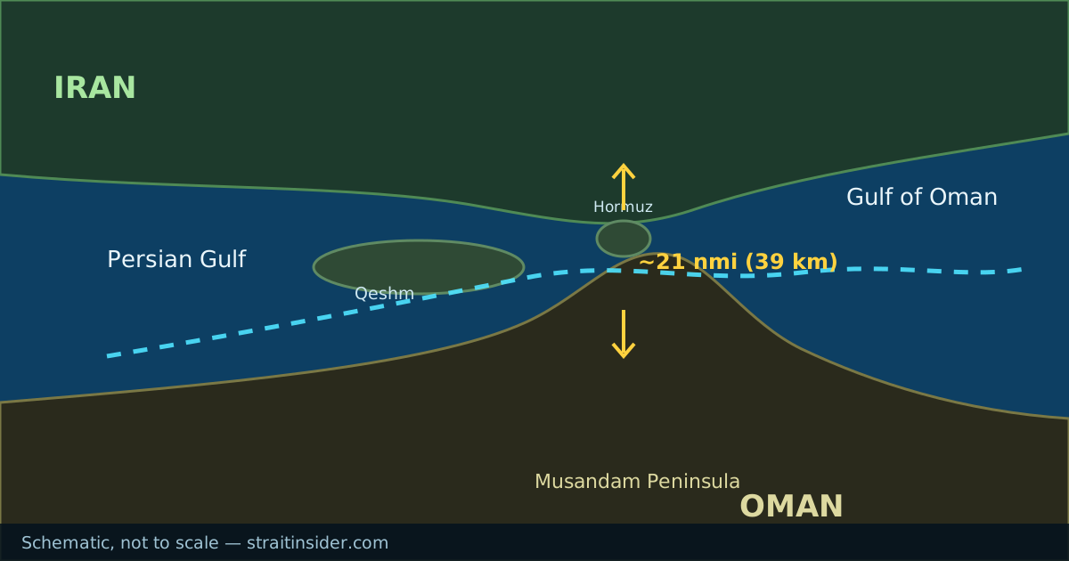
The narrows sit between the tip of Oman’s Musandam Peninsula and the Iranian shore, roughly between 26.5 and 26.7 degrees north and 56.2 to 56.5 east. That is given as a span deliberately: the narrowest cross-section is a line, not a point, and published widths vary partly because sources measure it in slightly different places. The width figures and the disagreement between them are here.
Hormuz Island, which gives the strait its name, lies north of the channel at about 27.06°N, 56.46°E. Qeshm, the largest island in the strait, runs north-west of it along the Iranian coast. The island chain has its own page.
All coordinates on this page are WGS 84, the datum used by GPS and by web mapping services. Older charts may use a local datum, in which case positions can differ by enough to matter for navigation.
If you are plotting this yourself
Paste 26.6, 56.5 into any mapping service and you will land in the middle of the channel, with the Musandam Peninsula to the south and Iran to the north. Our location map shows the same geography with the surrounding ports and the Gulf labelled, which is usually more legible than a satellite view at that zoom.
For navigation, use charted positions from a current chart. Coordinates on a reference page are for orientation, not for passage planning.
Common questions
- What is the latitude and longitude of the Strait of Hormuz?
- Latitude 26°36′N, longitude 56°30′E — or 26.6 and 56.5 in decimal degrees, on the WGS 84 datum.
- What are the coordinates of the Strait of Hormuz in decimal degrees?
- 26.6, 56.5. Written out in full for pasting into mapping software: 26.600000, 56.500000.
- What are the coordinates of the narrowest point?
- The narrows lie roughly between 26.5°N and 26.7°N and between 56.2°E and 56.5°E, between the Musandam Peninsula and the Iranian coast. It is a cross-section rather than a single point, which is part of why published widths differ.
- Which hemisphere is the Strait of Hormuz in?
- Northern and eastern — both the latitude and the longitude are positive. It sits at a similar latitude to Miami and the Canary Islands.