The Strait of Hormuz, explained
A short, plain guide to the waterway: where it is, which seas it joins, how it is shaped, and why so much attention lands on a channel you could cross in an afternoon.
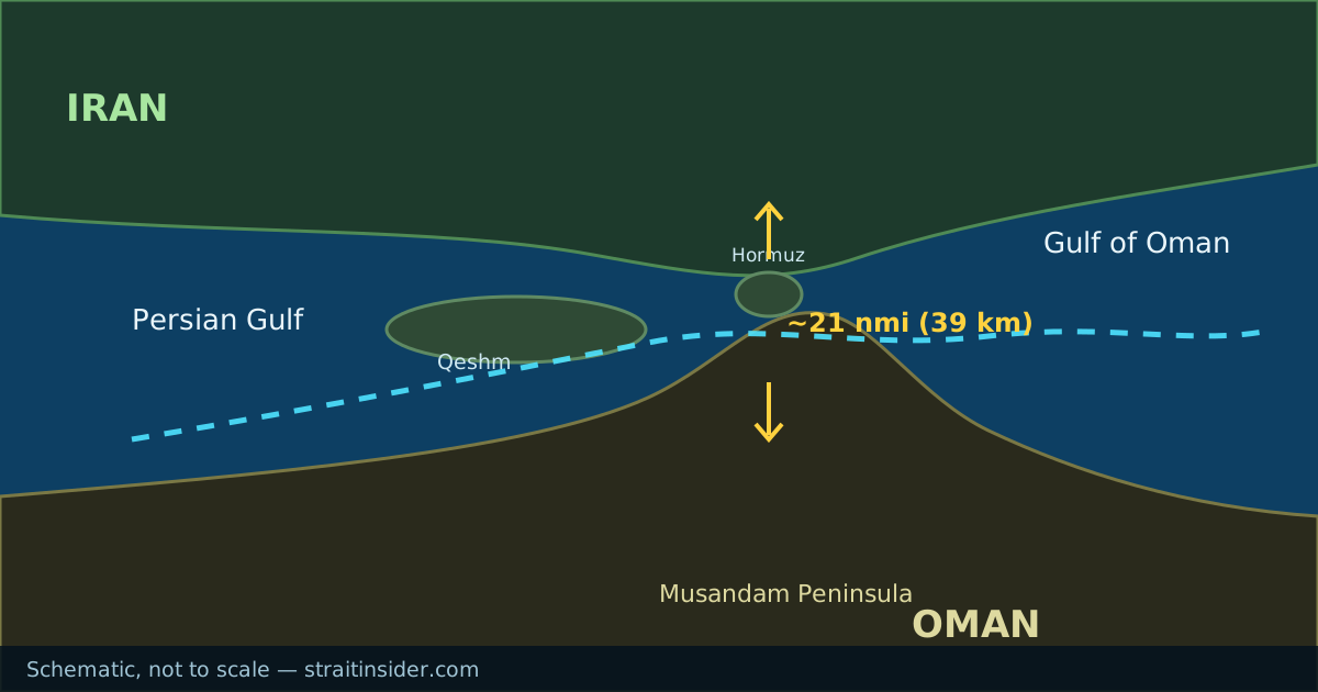
Where it is
The Strait of Hormuz is the sea passage connecting the Persian Gulf to the Gulf of Oman, and through it to the Arabian Sea and the wider Indian Ocean. Those are the two seas it joins, and it is the only sea route in or out of the Gulf.
Iran forms the northern shore. The southern shore is the Musandam Peninsula, an exclave of Oman, with the United Arab Emirates to the west of it. At its narrowest the strait is roughly 21 nautical miles across, about 39 kilometres — the full set of dimensions is here.
On a chart it sits at approximately 26.6 degrees north, 56.4 degrees east. A map of the channel and its lanes makes the shape easier to follow than coordinates do.
How traffic is organised
Shipping does not spread out across the channel. Vessels follow a traffic separation scheme: an inbound lane, an outbound lane, and a separation zone between them, each roughly two miles wide. The scheme lies within Omani territorial waters.
This is the same principle as a divided highway. Ships heading into the Gulf keep to one side, ships heading out keep to the other, and the median stops the two streams meeting head-on in a channel with limited room to manoeuvre.
Why a narrow channel matters
Geography does the work here. A large share of the oil and liquefied natural gas produced around the Gulf has no overland alternative that comes close to matching sea freight on cost or volume. Pipelines that bypass the strait exist, but their combined capacity is a fraction of what moves by sea.
That combination — high volume, no practical substitute, and a chokepoint you can see across on a clear day — is why the strait appears in energy analysis and security reporting far out of proportion to its size.
What this site is
This site hosts a browser game set in a stylised version of the strait, along with reference pages like this one. The game is fiction: invented hazards, invented routes, a distorted map. These reference pages are not, and where a figure moves from year to year we would rather point you at a primary source than quote a number that quietly goes stale.
Common questions
- How wide is the Strait of Hormuz?
- Roughly 21 nautical miles, about 39 kilometres, at its narrowest point. The navigable shipping lanes within it are considerably narrower.
- Which countries border the Strait of Hormuz?
- Iran to the north, and Oman — specifically the Musandam Peninsula exclave — to the south, with the United Arab Emirates adjacent to the west.
- Which two seas does the Strait of Hormuz connect?
- The Persian Gulf and the Gulf of Oman. The Gulf of Oman opens into the Arabian Sea and then the Indian Ocean, so the strait is the Gulf’s only link to the open ocean.
- Is the Strait of Hormuz open?
- Traffic has been far below normal since early 2026. The status page tracks transit volumes and links to the live sources.
- Is there another sea route out of the Persian Gulf?
- No. The Strait of Hormuz is the only sea passage in or out of the Gulf.