Reading a map of the Strait of Hormuz
The shape of the channel, the shipping lanes that run through it, and an honest account of where our game map departs from reality.
The shape of the channel
The strait bends. Traffic entering from the Gulf of Oman heads roughly north-west, then turns west into the Gulf itself. It is not a straight corridor, and the turn happens near the narrowest section, which is part of why the traffic separation scheme exists.
North of the channel sits a cluster of Iranian islands. South of it, the Musandam Peninsula pushes into the strait as a mountainous headland with deeply indented inlets.
The traffic separation scheme
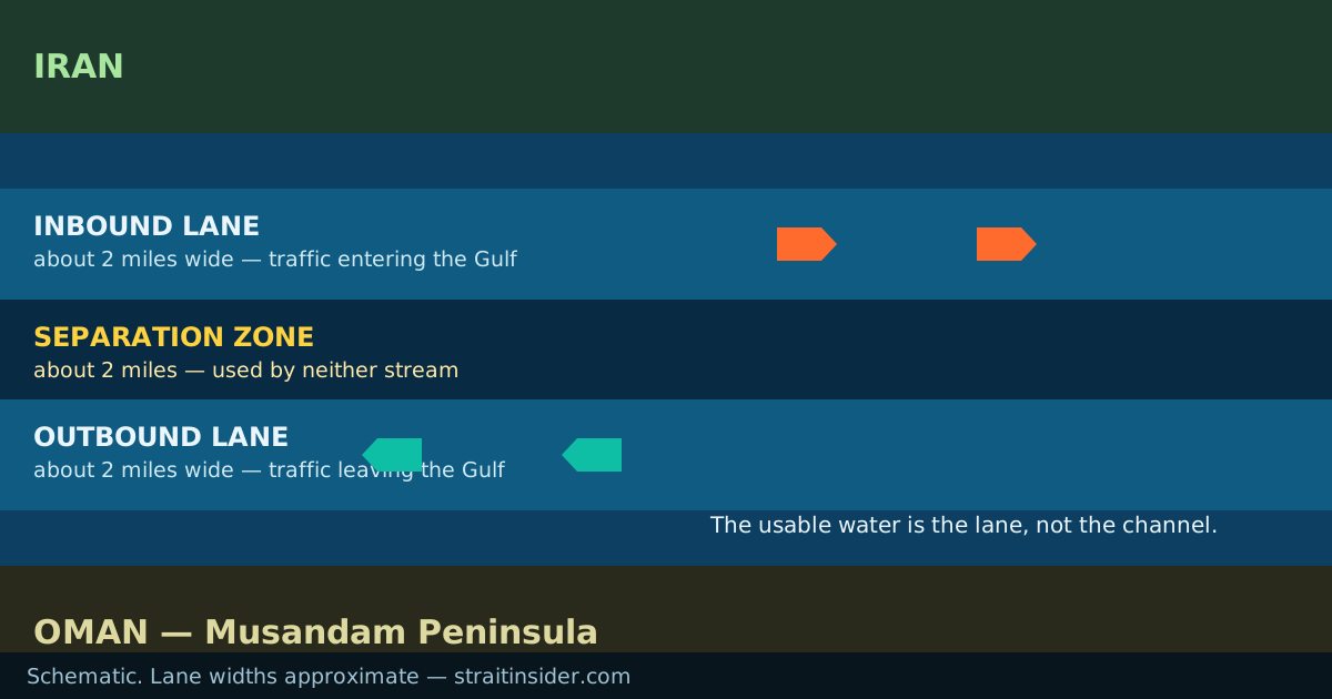
Inbound and outbound lanes each run about two miles wide, separated by a median of about the same width. That median is the separation zone: a strip of water that neither stream uses, which keeps opposing traffic apart in a channel with limited room.
Deep-draught vessels — loaded crude carriers in particular — have far less room to manoeuvre than the width of the strait suggests, because the usable water is the lane, not the channel. How that traffic actually moves is a separate question from the geography.
How the game map differs
Our map is a game map and should not be used to understand the real waterway. Specifically:
- The projection is stretched
- The crossing is compressed and the channel widened for playability.
- Islands are procedural
- Positions are inspired by real geography; shapes are generated, not surveyed.
- Names are invented
- Ports, landmarks and several islands carry fictional names.
- Hazards are fiction
- Nothing in the game reflects real conditions, positions or events.
Common questions
- Can I use the game map for navigation?
- No, and it is not close enough to reality to be useful for anything except playing the game. Use official charts and notices to mariners.